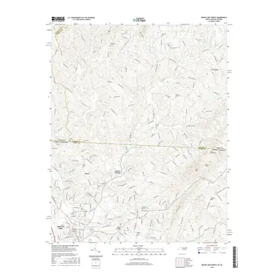
2016 Map of Mount Airy North
USGS Topo · Published 2016About this map
Mount Airy and the surrounding borderlands of Surry County and Virginia are defined by the winding course of the Ararat River. This 2016 survey highlights a landscape where traditional settlements like Salem, Flat Rock, and Sulphur Springs persist alongside numerous family and community burial grounds, such as Oakdale Cem and Gods Acre Cem. The terrain rises toward the Blue Ridge, with prominent elevations like Chestnut Ridge and Slate Mtn overlooking the valleys. The map documents the intricate rural road network, including family-named routes like Athey Simmons Rd and Deatherage Rd, which connect the scattered homesteads and small communities of Ararat and Paynetown. This survey provides essential detail for those tracing the geographic evolution of the North Carolina and Virginia state line, where the Virginia-North Carolina border splits the upland topography.
Find a feature on this map
189 named features on this map. Tap any name to fly to it.
Don’t see what you’re looking for? This feature index may not catch every label — zoom into the map to look around manually.
Map Details
Editions of this 2016 Mount Airy North Map
This is the sole edition of this map. No revisions or reprints were ever made.
Other maps of this area

1889 · Hillsville
USGS Topo · 1:125,000

1891 · Yadkinville
USGS Topo · 1:125,000

1892 · Hillsville
USGS Topo · 1:125,000

1893 · Yadkinville
USGS Topo · 1:125,000

1896 · Hillsville
USGS Topo · 1:125,000

1928 · Stuart
USGS Topo · 1:48,000

1931 · Stuart
USGS Topo · 1:62,500

1953 · Winston-Salem
USGS Topo · 1:250,000

1955 · Winston-Salem
USGS Topo · 1:250,000

1957 · Mount Airy
USGS Topo · 1:62,500