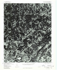
1976 Map of Mount Airy North
USGS Topo · Published 1979About this map
Mount Airy and its surrounding rural landscapes are captured here during the mid-1970s, showcasing the agricultural and wooded patterns of Surry County. This orthophotograph provides a rare photographic record of the terrain, where the Ararat River carves a path through the rolling foothills. The map documents established communities and small outlying settlements, such as Flat Rock, Toast, and Sulphur Springs, revealing the density of homesteads and the patchwork of cleared fields. North of the main town, the area transitions into the more sparsely populated regions of Ararat and The Hollow, tracing the transition from the growing urban edge of the city toward the more secluded valleys. These aerial details allow for a precise study of property boundaries and land use before subsequent decades of development changed the local footprint.
Find a feature on this map
7 named features on this map. Tap any name to fly to it.
Don’t see what you’re looking for? This feature index may not catch every label — zoom into the map to look around manually.
Map Details
Editions of this 1976 Mount Airy North Map
This is the sole edition of this map. No revisions or reprints were ever made.
Other maps of this area

1889 · Hillsville
USGS Topo · 1:125,000

1891 · Yadkinville
USGS Topo · 1:125,000

1892 · Hillsville
USGS Topo · 1:125,000

1893 · Yadkinville
USGS Topo · 1:125,000

1896 · Hillsville
USGS Topo · 1:125,000

1928 · Stuart
USGS Topo · 1:48,000

1931 · Stuart
USGS Topo · 1:62,500

1953 · Winston-Salem
USGS Topo · 1:250,000

1955 · Winston-Salem
USGS Topo · 1:250,000

1957 · Mount Airy
USGS Topo · 1:62,500