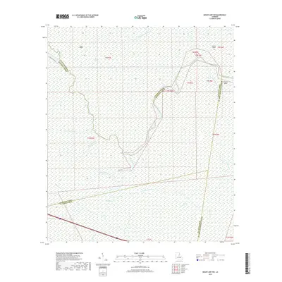
2018 Map of Mount Airy NW
USGS Topo · Published 2018About this map
Blind River and its intricate network of bayous and canals dominate this 2018 survey of the low-lying wetlands where Livingston, Ascension, St. James, and St. John the Baptist Parishes meet. The landscape is defined by its waterborne geography, featuring the confluence of the Amite River and Petite Amite River alongside landforms like Sarah Ridge and Alligator Island. This map illustrates the modern hydrology of the region, where natural channels like Bayou Cheng Blanc and Bayou Repands Pas exist alongside man-made drainage systems like the Bourgeois Canal and New River Canal. While largely uninhabited marshland, the map traces the subtle elevation changes that have historically guided settlement and travel in this corner of south Louisiana, including the named curve at Devils Elbow.
Find a feature on this map
25 named features on this map. Tap any name to fly to it.
Don’t see what you’re looking for? This feature index may not catch every label — zoom into the map to look around manually.
Map Details
Editions of this 2018 Mount Airy NW Map
This is the sole edition of this map. No revisions or reprints were ever made.
Other maps of this area

1892 · Mount Airy
USGS Topo · 1:62,500

1892 · Donaldsonville
USGS Topo · 1:62,500

1934 · Denham Springs
USGS Topo · 1:62,500

1934 · Springfield
USGS Topo · 1:62,500

1939 · Springfield
USGS Topo · 1:62,500

1939 · Denham Springs
USGS Topo · 1:62,500

1939 · Donaldsonville
USGS Topo · 1:62,500

1946 · North of Garyville
USGS Topo · 1:31,680

1946 · Convent
USGS Topo · 1:31,680
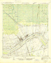
1946 · Lutcher
USGS Topo · 1:31,680
Featured Places
- Livingston Parish, LA
- Ascension Parish, LA
- St. John the Baptist Parish, LA
- St. James Parish, LA
- United States