1946 Map of North of Garyville
USGS Topo · Published 1946About this map
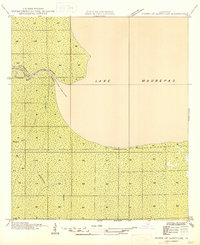
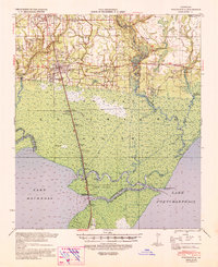
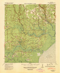
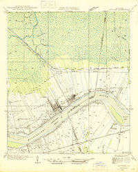
The swampy lowlands bordering Lake Maurepas define this 1940s survey of the Louisiana wetlands. The landscape is dominated by a complex network of waterways, including Blind River and Alligator Bayou, which mark the boundary between Livingston and St. John the Baptist Parishes. Human activity in this saturated terrain is sparse, centered primarily on the southern shore of the lake at Lutcher-Moore Camp, a site linked to the regional logging and timber industry. The map illustrates the natural drainage patterns of the era, where seasonal waters move through Dutch Bayou, Bayou Tent, and the winding Mississippi Bayou. This chart reflects the coastal wilderness before modern industrial expansion, capturing the intricate hydrography of the Maurepas basin.
Find a feature on this map
8 named features on this map. Tap any name to fly to it.
Don’t see what you’re looking for? This feature index may not catch every label — zoom into the map to look around manually.
Map Details
Editions of this 1946 North of Garyville Map
This is the sole edition of this map. No revisions or reprints were ever made.
Other maps of this area

1892 · Mount Airy
USGS Topo · 1:62,500

1892 · Bonnet Carre
USGS Topo · 1:62,500

1934 · Springfield
USGS Topo · 1:62,500
1935 · Laplace
USGS Topo · 1:31,680
1935 · Ponchatoula
USGS Topo · 1:62,500
1936 · Ruddock
USGS Topo · 1:31,680

1936 · Bonnet Carre
USGS Topo · 1:62,500
1939 · Ponchatoula
USGS Topo · 1:62,500
1939 · Springfield
USGS Topo · 1:62,500
1946 · Lutcher
USGS Topo · 1:31,680