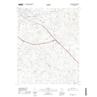
2019 Map of Mount Airy South
USGS Topo · Published 2019About this map
The Ararat River system dominates the southern reaches of Mount Airy in this 2019 survey, illustrating the modern rural-urban interface of Surry County. While the city's denser street grid occupies the northwestern corner, the landscape quickly transitions into a network of small named settlements and agricultural tracts. Communities such as Bannertown, Boones Hill, and Ash Hill are linked by a complex web of roads like Ararat Rd and Bryant Mill Rd, highlighting the persistent importance of local crossroads in North Carolina's Piedmont region.
Find a feature on this map
208 named features on this map. Tap any name to fly to it.
Don’t see what you’re looking for? This feature index may not catch every label — zoom into the map to look around manually.
Map Details
Editions of this 2019 Mount Airy South Map
This is the sole edition of this map. No revisions or reprints were ever made.
Other maps of this area

1889 · Hillsville
USGS Topo · 1:125,000

1891 · Yadkinville
USGS Topo · 1:125,000

1892 · Hillsville
USGS Topo · 1:125,000

1893 · Yadkinville
USGS Topo · 1:125,000

1896 · Hillsville
USGS Topo · 1:125,000

1928 · Stuart
USGS Topo · 1:48,000

1931 · Stuart
USGS Topo · 1:62,500

1953 · Winston-Salem
USGS Topo · 1:250,000

1955 · Winston-Salem
USGS Topo · 1:250,000

1957 · Mount Airy
USGS Topo · 1:62,500