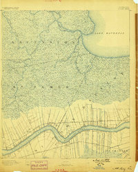
1892 Map of Mount Airy
USGS Topo · Published 1898About this map
Long, narrow riverfront tracts define the settlement pattern along the Mississippi River in this late nineteenth-century landscape. These long lots, or arpent tracts, stretch back from the riverbanks towards the dense swamp hinterlands, reflecting the traditional French colonial method of land division that ensured water access for every landowner. Along the northern bank, the New Orleans and Texas Pacific Railroad cuts across these holdings, connecting river communities like Mt. Airy, Terre Haute, and Belle Point.
Find a feature on this map
34 named features on this map. Tap any name to fly to it.
Don’t see what you’re looking for? This feature index may not catch every label — zoom into the map to look around manually.
Map Details
Editions of this 1892 Mount Airy Map
4 editions found
Other maps of this area

1891 · Hahnville
USGS Topo · 1:62,500

1892 · Lac Des Allemands
USGS Topo · 1:62,500

1892 · Mount Airy
USGS Topo · 1:62,500

1892 · Bonnet Carre
USGS Topo · 1:62,500

1892 · Donaldsonville
USGS Topo · 1:62,500

1892 · Thibodaux
USGS Topo · 1:62,500

1932 · Lac Des Allemands NW
USGS Topo · 1:31,680

1932 · Thibodaux NE
USGS Topo · 1:31,680

1932 · Hahnville NW
USGS Topo · 1:31,680

1932 · Lac Des Allemands NE
USGS Topo · 1:31,680