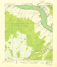
1892 Map of Mount Airy
USGS Topo · Published 1919About this map
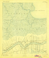
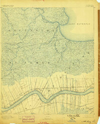
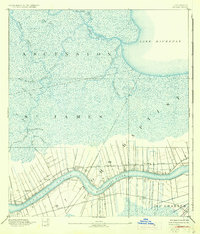
Long lot river-frontage properties define the riverbank of the Mississippi River in this late 19th-century survey, stretching inland toward the vast swampy reaches of St James and St John the Baptist parishes. Two major rail corridors, the Louisville New Orleans and Texas Railroad on the north bank and the Texas and Pacific Railroad on the south bank, follow the river's curve through a landscape of established plantations and landings. Small riverside settlements like Mt Airy, Edgard, and Belle Point sit at the nexus of water and rail transport.
Find a feature on this map
36 named features on this map. Tap any name to fly to it.
Don’t see what you’re looking for? This feature index may not catch every label — zoom into the map to look around manually.
Map Details
Editions of this 1892 Mount Airy Map
4 editions found
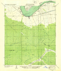
Other maps of this area

1891 · Hahnville
USGS Topo · 1:62,500

1892 · Lac Des Allemands
USGS Topo · 1:62,500

1892 · Mount Airy
USGS Topo · 1:62,500

1892 · Bonnet Carre
USGS Topo · 1:62,500

1892 · Donaldsonville
USGS Topo · 1:62,500

1892 · Thibodaux
USGS Topo · 1:62,500

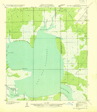
1932 · Lac Des Allemands NW
USGS Topo · 1:31,680
1932 · Thibodaux NE
USGS Topo · 1:31,680
1932 · Hahnville NW
USGS Topo · 1:31,680
1932 · Lac Des Allemands NE
USGS Topo · 1:31,680