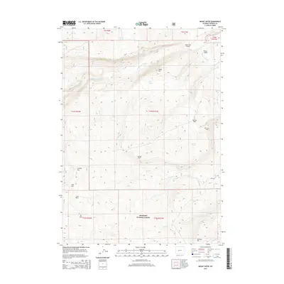
2015 Map of Mount Arter
USGS Topo · Published 2015About this map
The Shoshone National Forest dominates this landscape, rising to the high peak of Mt Arter and the surrounding wilderness of the Cony Basin. The terrain is deeply cut by the N Popo Agie River, which flows through the North Fork Canyon in the northern reaches of the quadrangle. Early water management is evident in the presence of the Brown Jug Ditch and Standish Ditch near Bragg Canyon. Local toponyms suggest historical ties to early explorers and settlers, seen in features like Uncle Tom Spring, Mormon Spring, and the prominent Suicide Point overlooking the drainage of Baldwin Cr. Significant mountain passes, including Cyclone Pass and Cony Pass, mark the high-altitude routes through this part of the Wind River Range.
Find a feature on this map
37 named features on this map. Tap any name to fly to it.
Don’t see what you’re looking for? This feature index may not catch every label — zoom into the map to look around manually.
Map Details
Editions of this 2015 Mount Arter Map
This is the sole edition of this map. No revisions or reprints were ever made.
Other maps of this area

1937 · Moccasin Lake
USGS Topo · 1:48,000

1943 · Moccasin Lake
USGS Topo · 1:62,500

1952 · Ray Lake
USGS Topo · 1:24,000

1952 · Wind River
USGS Topo · 1:24,000

1953 · Sweetwater Gap
USGS Topo · 1:24,000

1953 · Cony Mountain
USGS Topo · 1:24,000

1953 · Mount Arter
USGS Topo · 1:24,000

1953 · Fossil Hill
USGS Topo · 1:24,000

1953 · Mount Arter SE
USGS Topo · 1:24,000

1955 · Lander
USGS Topo · 1:250,000