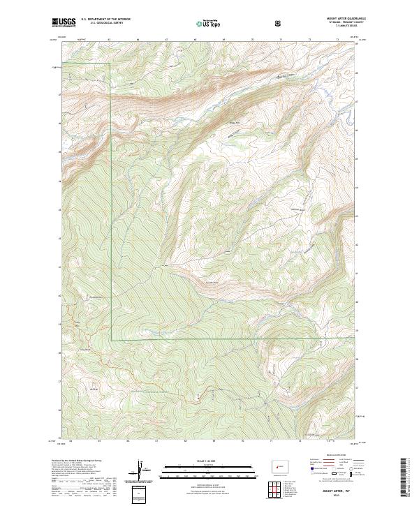
2023 Map of Mount Arter
USGS Topo · Published 2023About this map
Shoshone National Forest dominates this high-altitude landscape in Fremont County, where the southern Wind River Range terrain defines the local geography. The map provides a look at the intricate water systems essential to the region, including the North Popo Agie River and its canyons, alongside early irrigation efforts seen in the Brown Jug Ditch and Cavendish Ditch. Cultural history is etched into the landscape through names like Mormon Basin, Mormon Gulch, and Mormon Spring, suggesting the paths of early settlers and pioneers. High-elevation points such as Mt Arter and the starkly named Suicide Point overlook a network of backcountry routes, including the Farlow Trl and Cony Pass Trl, which navigate through Cony Basin and across several mountain passes. This survey serves as a primary record of the drainage patterns from Bragg Mtn and the various springs, such as Uncle Tom Spring and Charcoal Spring, that feed into the larger river systems.
Find a feature on this map
37 named features on this map. Tap any name to fly to it.
Don’t see what you’re looking for? This feature index may not catch every label — zoom into the map to look around manually.
Map Details
Editions of this 2023 Mount Arter Map
This is the sole edition of this map. No revisions or reprints were ever made.
Other maps of this area

1937 · Moccasin Lake
USGS Topo · 1:48,000

1943 · Moccasin Lake
USGS Topo · 1:62,500

1952 · Ray Lake
USGS Topo · 1:24,000

1952 · Wind River
USGS Topo · 1:24,000

1953 · Sweetwater Gap
USGS Topo · 1:24,000

1953 · Cony Mountain
USGS Topo · 1:24,000

1953 · Mount Arter
USGS Topo · 1:24,000

1953 · Fossil Hill
USGS Topo · 1:24,000

1953 · Mount Arter SE
USGS Topo · 1:24,000

1955 · Lander
USGS Topo · 1:250,000