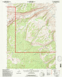
1991 Map of Mount Arter
USGS Topo · Published 1997About this map
The Wind River Indian Reservation and Shoshone National Forest meet in this 1991 revision, a landscape defined by sharp elevation shifts and high-altitude water sources. The North Popo Agie River carves through the northern portion of the map, fed by numerous drainages like Agie Canyon and Bragg Canyon. This area illustrates the transition from managed forest lands to tribal territory, marked by the Reservation Boundary running north-to-south. Settlement is sparse, represented by isolated outposts such as the Pine Bar Ranch, Hart Ranch, and the Farlow Homestead, which suggest a history of ranching and early irrigation efforts like the Standish Ditch. Notable geographic landmarks including Suicide Point, Mount Arter, and Cyclone Pass provide significant orientation points for genealogists or historians tracing the movement of early pioneers and forest rangers through the Lander Ranger District.
Find a feature on this map
38 named features on this map. Tap any name to fly to it.
Don’t see what you’re looking for? This feature index may not catch every label — zoom into the map to look around manually.
Map Details
Editions of this 1991 Mount Arter Map
This is the sole edition of this map. No revisions or reprints were ever made.
Other maps of this area

1937 · Moccasin Lake
USGS Topo · 1:48,000

1943 · Moccasin Lake
USGS Topo · 1:62,500

1952 · Ray Lake
USGS Topo · 1:24,000

1952 · Wind River
USGS Topo · 1:24,000

1953 · Sweetwater Gap
USGS Topo · 1:24,000

1953 · Cony Mountain
USGS Topo · 1:24,000

1953 · Mount Arter
USGS Topo · 1:24,000

1953 · Fossil Hill
USGS Topo · 1:24,000

1953 · Mount Arter SE
USGS Topo · 1:24,000

1955 · Lander
USGS Topo · 1:250,000