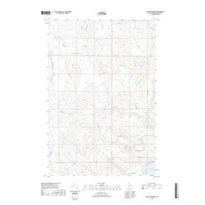
2018 Map of Mount Ashwabay
USGS Topo · Published 2018About this map
Mount Ashwabay rises as the central topographical anchor for this coastal portion of Bayfield County, where the highlands of Northern Wisconsin meet the shore of Lake Superior. The landscape is defined by a dense network of watercourses, including the Sand River, Raspberry River, and Pikes Creek, alongside specialized terrain such as Sultz Swamp. Near the southern lakefront, the recreation-focused geography becomes evident through specifically named trails and runs like Hooten Hollow, Trogdor, and Diesel Bear, while local infrastructure is represented by the Echo Valley Gravel Pit Road and Bayview Park Road. The distribution of fire lanes, including Schultz Fire Lane and Smith Fire Lane, indicates the managed forest character of this region during the 21st century.
Find a feature on this map
34 named features on this map. Tap any name to fly to it.
Don’t see what you’re looking for? This feature index may not catch every label — zoom into the map to look around manually.
Map Details
Editions of this 2018 Mount Ashwabay Map
This is the sole edition of this map. No revisions or reprints were ever made.
Other maps of this area

1941 · Bayfield
USGS Topo · 1:48,000

1942 · Ashland
USGS Topo · 1:48,000

1944 · Moquah
USGS Topo · 1:48,000

1944 · Cornucopia
USGS Topo · 1:48,000

1946 · Cornucopia
USGS Topo · 1:48,000

1946 · Bayfield
USGS Topo · 1:48,000

1947 · Moquah
USGS Topo · 1:48,000

1947 · Ashland
USGS Topo · 1:48,000

1953 · Ashland
USGS Topo · 1:250,000

1958 · Ashland
USGS Topo · 1:250,000