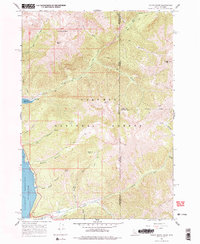
1966 Map of Mount Baird
USGS Topo · Published 1978About this map
Mount Baird and Elkhorn Peak dominate the high-altitude landscape of the Targhee National Forest, straddling the border between Idaho and Wyoming in the mid-1960s. This survey records a wilderness shaped by deep drainages and high ridges, where recreation and conservation intersect along the eastern shore of the Palisades Reservoir. The map details specific lakeside developments like the YMCA Camp and Big Elk Creek Campground, which serve as gateways to an extensive network of Pack Trails and Jeep Trails threading through the backcountry. Notable geological and topographical points of interest include the sheer rise of Needle Peak, the secluded Spaulding Basin, and the winding paths of Big Elk Creek and Little Elk Creek. The presence of the Palisades Reservoir, with its underwater contours mapped by the Bureau of Reclamation, highlights the era's focus on water management and its impact on the region's geography.
Find a feature on this map
36 named features on this map. Tap any name to fly to it.
Don’t see what you’re looking for? This feature index may not catch every label — zoom into the map to look around manually.
Map Details
Editions of this 1966 Mount Baird Map
2 editions found
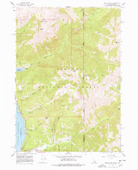
Other maps of this area

1931 · Jackson
USGS Topo · 1:125,000

1932 · Irwin
USGS Topo · 1:96,000

1935 · Irwin
USGS Topo · 1:125,000

1935 · Jackson
USGS Topo · 1:125,000

1955 · Driggs
USGS Topo · 1:250,000

1958 · Driggs
USGS Topo · 1:250,000

1962 · Driggs
USGS Topo · 1:250,000

1963 · Teton Pass
USGS Topo · 1:24,000

1963 · Observation Peak
USGS Topo · 1:24,000

1963 · Ferry Peak
USGS Topo · 1:24,000