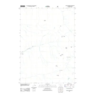
2012 Map of Mount Bannon
USGS Topo · Published 2012About this map
Mount Bannon and the surrounding high country of the Teton Range are meticulously detailed in this early 21st-century survey. The landscape is defined by its extreme verticality, featuring dramatic landforms like the Death Canyon Shelf and the jagged ascent of the Devils Stairs. Water drains from these heights through numerous forks, including the N Fork Darby Cr and S Fork Teton Cr, which feed into the valley systems below. At the end of Darby Canyon Rd, the Darby Girls Camp sits as a rare point of human infrastructure at the edge of the wilderness. To the south, high-altitude water bodies such as Pass Lake, Indian Lake, and the uniquely named Forget-me-not Lakes occupy the basins between summits like Fossil Mountain and Spearhead Peak.
Find a feature on this map
24 named features on this map. Tap any name to fly to it.
Don’t see what you’re looking for? This feature index may not catch every label — zoom into the map to look around manually.
Map Details
Editions of this 2012 Mount Bannon Map
This is the sole edition of this map. No revisions or reprints were ever made.
Other maps of this area

1899 · Grand Teton
USGS Topo · 1:125,000

1901 · Grand Teton
USGS Topo · 1:125,000

1943 · Driggs
USGS Topo · 1:62,500

1946 · Driggs
USGS Topo · 1:62,500

1955 · Driggs
USGS Topo · 1:250,000

1958 · Driggs
USGS Topo · 1:250,000

1962 · Driggs
USGS Topo · 1:250,000

1965 · Clawson
USGS Topo · 1:24,000
1968 · Granite Basin
USGS Topo · 1:24,000
1968 · Teton Village
USGS Topo · 1:24,000