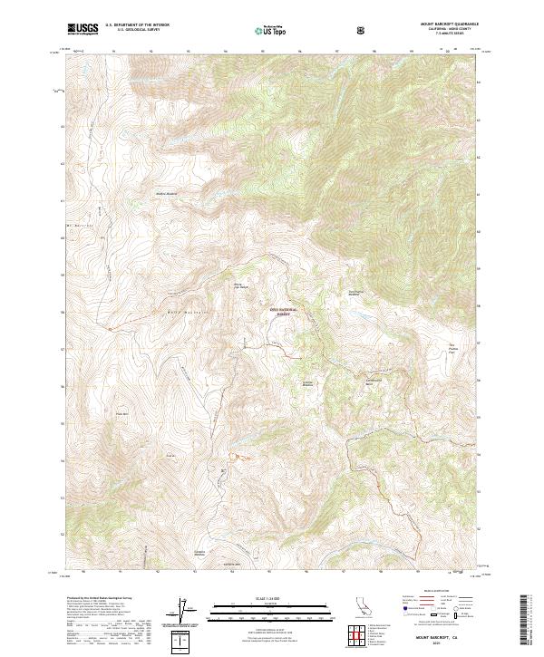
2021 Map of Mount Barcroft
USGS Topo · Published 2021About this map
Mt Barcroft and the surrounding high-elevation terrain of the White Mountains dominate this survey of the White-Inyo Range. Located within the Inyo National Forest, the landscape is defined by a series of high meadows and basins, including McAfee Meadow and Cottonwood Basin, connected by a network of historic pathways such as the Cottonwood Stock Trail. The presence of the Patriarch Grove highlights the area's importance for ancient bristlecone pine conservation, while summits like Piute Mtn and Sheep Mtn mark the hydrological divide. Water flows from these heights through numerous drainages, most notably McAfee Creek and the Cottonwood Creek Wild and Scenic River. The map also captures the route of White Mtn Road, the primary artery for access into this high-desert alpine environment.
Find a feature on this map
34 named features on this map. Tap any name to fly to it.
Don’t see what you’re looking for? This feature index may not catch every label — zoom into the map to look around manually.
Map Details
Editions of this 2021 Mount Barcroft Map
This is the sole edition of this map. No revisions or reprints were ever made.
Other maps of this area

1913 · Bishop
USGS Topo · 1:125,000

1917 · White Mountain
USGS Topo · 1:125,000

1947 · Mariposa
USGS Topo · 1:250,000

1948 · Mariposa
USGS Topo · 1:250,000

1949 · Bishop
USGS Topo · 1:62,500

1951 · Bishop
USGS Topo · 1:62,500

1951 · Blanco Mountain
USGS Topo · 1:62,500

1957 · Mariposa
USGS Topo · 1:250,000

1962 · Mt. Barcroft
USGS Topo · 1:62,500

1962 · White Mtn. Peak
USGS Topo · 1:62,500