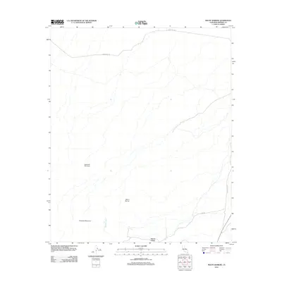
2012 Map of Mount Barrow
USGS Topo · Published 2012About this map
Imperial Gables sits along the southern edge of this desert landscape, where the elevation begins to rise toward the high peaks of the Chocolate Mountains. The terrain is defined by a series of drainage systems, most notably Ninemile Wash, which cuts a path through the arid flats between prominent landmarks like Mount Barrow and the sharp profile of Sawtooth Mountain. Transportation through this isolated corner of the county is limited to a few arterial routes, including Midway Well Rd across the northern reaches and Blythe Ogilby Rd to the east. This U.S. Geological Survey documentation captures the intersection of desert infrastructure and natural topography, illustrating how roads like Lowe Rd navigate the alluvial fans and ridges of the Colorado Desert.
Find a feature on this map
8 named features on this map. Tap any name to fly to it.
Don’t see what you’re looking for? This feature index may not catch every label — zoom into the map to look around manually.
Map Details
Editions of this 2012 Mount Barrow Map
This is the sole edition of this map. No revisions or reprints were ever made.
Other maps of this area

1942 · Blythe
USGS Topo · 1:250,000

1953 · Palo Verde Mountains
USGS Topo · 1:62,500

1953 · Quartz Peak
USGS Topo · 1:62,500

1953 · Chuckwalla Spring
USGS Topo · 1:62,500

1953 · Acolita
USGS Topo · 1:62,500

1954 · Salton Sea
USGS Topo · 1:250,000

1955 · Salton Sea
USGS Topo · 1:250,000

1959 · Salton Sea
USGS Topo · 1:250,000

1963 · Salton Sea
USGS Topo · 1:250,000

1965 · Salton Sea
USGS Topo · 1:250,000