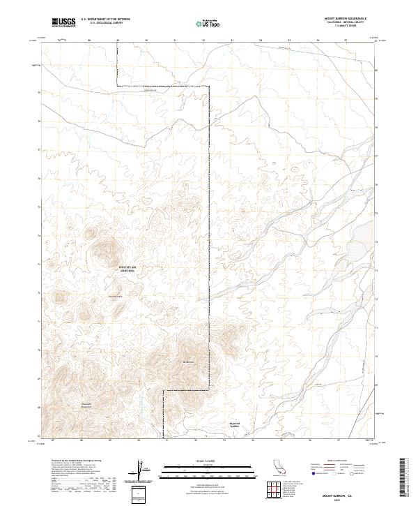
2021 Map of Mount Barrow
USGS Topo · Published 2021About this map
The Chocolate Mountains dominate this portion of Imperial County, California, showing a landscape defined by dramatic elevation changes and desert drainages. Central to the topography is Mt Barrow, which stands as a prominent high point north of the seasonal Ninemile Wash. The small settlement of Imperial Gables is situated in the southeastern corner of the quadrangle, serving as a rare point of human habitation in an otherwise arid expanse. Transportation through this desert environment relies on a sparse network of unpaved routes, including Midway Well Rd in the north and Lowe Rd and Imperial Gables Rd in the south. The presence of Sawtooth Mtn further characterizes the jagged terrain, providing a clear picture of the desert's physical geography before it descends toward the regional thoroughfare of Blythe Ogilby Rd.
Find a feature on this map
13 named features on this map. Tap any name to fly to it.
Don’t see what you’re looking for? This feature index may not catch every label — zoom into the map to look around manually.
Map Details
Editions of this 2021 Mount Barrow Map
This is the sole edition of this map. No revisions or reprints were ever made.
Other maps of this area

1942 · Blythe
USGS Topo · 1:250,000

1953 · Palo Verde Mountains
USGS Topo · 1:62,500

1953 · Quartz Peak
USGS Topo · 1:62,500

1953 · Chuckwalla Spring
USGS Topo · 1:62,500

1953 · Acolita
USGS Topo · 1:62,500

1954 · Salton Sea
USGS Topo · 1:250,000

1955 · Salton Sea
USGS Topo · 1:250,000

1959 · Salton Sea
USGS Topo · 1:250,000

1963 · Salton Sea
USGS Topo · 1:250,000

1965 · Salton Sea
USGS Topo · 1:250,000