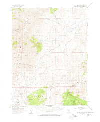
1956 Map of Mount Callaghan
USGS Topo · Published 1963About this map
Mount Callaghan dominates the northern reaches of the Shoshone Range in this mid-century Nevada survey, where the high mountain slopes descend into the wide expanse of Grass Valley. This is a landscape of established high-desert ranching, marked by family-named operations including the Grass Valley Ranch, Callaghan Ranch, and Streshley Ranch. The distribution of water is central to life here, with numerous vital points such as Rye Patch Spring, Burton Spring, and Streshley Spring sustaining both livestock and local residents near the southern boundary of the Toiyabe National Forest.
Find a feature on this map
36 named features on this map. Tap any name to fly to it.
Don’t see what you’re looking for? This feature index may not catch every label — zoom into the map to look around manually.
Map Details
Editions of this 1956 Mount Callaghan Map
3 editions found
Other maps of this area

1926 · Roberts Mountains
USGS Topo · 1:250,000

1929 · Roberts Mountains
USGS Topo · 1:250,000

1955 · Millett
USGS Topo · 1:250,000

1956 · Mount Callaghan
USGS Topo · 1:62,500

1956 · Walti Hot Springs
USGS Topo · 1:62,500

1956 · Hall Creek
USGS Topo · 1:62,500

1956 · Ackerman Canyon
USGS Topo · 1:62,500

1956 · Austin
USGS Topo · 1:62,500

1959 · Millett
USGS Topo · 1:250,000

1960 · Hickison Summit
USGS Topo · 1:62,500