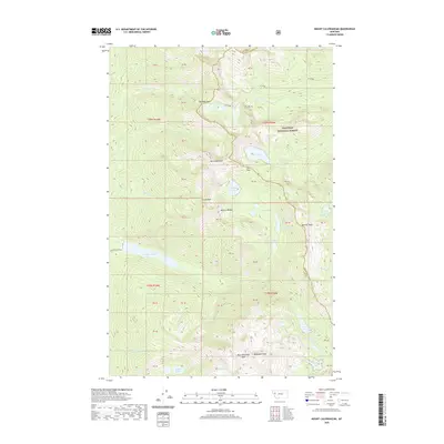
2020 Map of Mount Calowahcan
USGS Topo · Published 2020About this map
The Mission Range dominates this portion of the Flathead National Forest, forming a high-elevation divide between Lake and Missoula Counties. This 2020 survey details a landscape defined by extreme relief, where glacial cirques hold numerous alpine water bodies including the Mollman Lakes, Summit Lake, and the remote Ashley Lakes. High peaks like Mt Calowahcan and McDonald Peak tower over the drainage basins of Post Cr and Mollman Cr. Human access is limited to a few corridor routes such as the Eagle Pass Tr and the winding McDonald Lake Rd, which leads toward the larger McDonald Lake at the range's base. The map illustrates the complex hydrography of the region, where streams like S Fork Elk Cr and Crazy Horse Cr descend from ridges like Elk Ridge, feeding into a network of isolated lakes such as Spook Lake and Frog Lakes.
Find a feature on this map
37 named features on this map. Tap any name to fly to it.
Don’t see what you’re looking for? This feature index may not catch every label — zoom into the map to look around manually.
Map Details
Editions of this 2020 Mount Calowahcan Map
This is the sole edition of this map. No revisions or reprints were ever made.
Other maps of this area

1920 · Flathead Lake
USGS Topo · 1:125,000

1921 · Elbow Lake
USGS Topo · 1:125,000

1955 · Choteau
USGS Topo · 1:250,000

1956 · Wallace
USGS Topo · 1:250,000

1957 · Choteau
USGS Topo · 1:250,000

1958 · Choteau
USGS Topo · 1:250,000

1960 · Wallace
USGS Topo · 1:250,000

1962 · Choteau
USGS Topo · 1:250,000

1964 · Fort Connah
USGS Topo · 1:24,000

1964 · Ronan
USGS Topo · 1:24,000