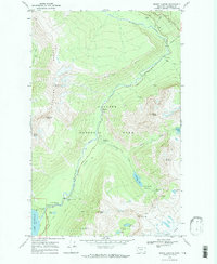
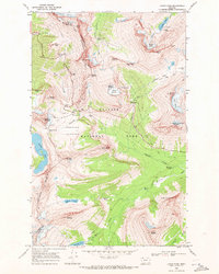
1968 Map of Mount Cannon
USGS Topo · Published 1971About this map
Glacier National Park dominates this 1968 field-checked survey, centering on the high-altitude pass where the Going-To-The-Sun Road winds through the Livingstone Range. The map documents the peak era of mid-century park infrastructure, featuring the Avalanche Campground, a Ranger Station, and the Mount Brown Lookout. It reveals a landscape shaped by ice and water, from the remnants of the Sperry Glacier to the many named falls like McDonald Falls and the Sacred Dancing Cascade. Hikers and researchers can trace the original paths of the Avalanche Trail as it moves past Avalanche Lake toward the massive natural barrier known as The Wall. The inclusion of isolated outposts like Packers Roost and a Patrol Cabin reflects the traditional backcountry management and fire-watching systems in place before modern satellite communication and aerial surveillance became standard.
Find a feature on this map
44 named features on this map. Tap any name to fly to it.
Don’t see what you’re looking for? This feature index may not catch every label — zoom into the map to look around manually.
Map Details
Editions of this 1968 Mount Cannon Map
2 editions found
Other maps of this area

1904 · Chief Mountain
USGS Topo · 1:125,000

1938 · Chief Mountain
USGS Topo · 1:125,000

1960 · Cut Bank
USGS Topo · 1:250,000

1963 · Cut Bank
USGS Topo · 1:250,000

1964 · Cut Bank
USGS Topo · 1:250,000

1968 · Ahern Pass
USGS Topo · 1:24,000
1968 · Lake Mc Donald West
USGS Topo · 1:24,000
1968 · Mount Cannon
USGS Topo · 1:24,000
1968 · Camas Ridge East
USGS Topo · 1:24,000
1968 · Logan Pass
USGS Topo · 1:24,000