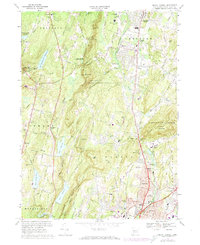
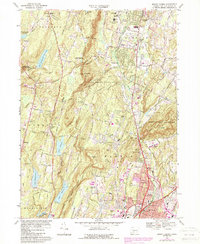
1967 Map of Mount Carmel
USGS Topo · Published 1974About this map
Sleeping Giant State Park dominates the eastern skyline of this New Haven County landscape, where the distinctive profile of Mt Carmel rises above the Quinnipiac River valley. The map reveals a suburbanizing terrain in the late 1960s and early 1970s, as the Wilbur Cross Parkway and Whitney Ave channel traffic through Hamden and Centerville. Local history is anchored by institutional landmarks such as Our Lady of LaSalette Seminary and the Agricultural Experiment Sta near the Penn Central rail line.
Find a feature on this map
73 named features on this map. Tap any name to fly to it.
Don’t see what you’re looking for? This feature index may not catch every label — zoom into the map to look around manually.
Map Details
Editions of this 1967 Mount Carmel Map
5 editions found
Other maps of this area

1889 · Derby
USGS Topo · 1:62,500

1891 · Derby
USGS Topo · 1:62,500

1892 · New Haven
USGS Topo · 1:62,500

1892 · Meriden
USGS Topo · 1:62,500

1893 · Waterbury
USGS Topo · 1:62,500

1893 · Meriden
USGS Topo · 1:62,500

1893 · Derby
USGS Topo · 1:62,500

1904 · Waterbury
USGS Topo · 1:62,500

1904 · Litchfield
USGS Topo · 1:125,000

1906 · Farmington
USGS Topo · 1:125,000