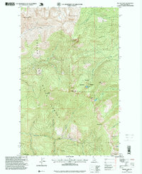
1996 Map of Mount Casey
USGS Topo · Published 1999About this map
Mount Casey stands as a central peak in this wilderness landscape, where the Kaniksu National Forest and Priest Lake State Forest converge. The topography is defined by the headwaters of the East Fork Priest Lake and numerous drainages like Hellroaring Creek and Berry Creek. Higher elevations are marked by the Caribou Lookout and the Schweitzer Basin Ski Area to the southeast, indicating the development of recreation alongside the older timber and resource management of the Selkirk Mountains. Small high-mountain lakes including Caribou Lake, Keokee Lake, and Colburn Lake are tucked into the drainages below ridges like Hellroaring Ridge. Traces of earlier human activity appear in labels like Prospect, hinting at the mineral exploration that once drew people into these remote Idaho basins during the late nineteenth and early twentieth centuries.
Find a feature on this map
29 named features on this map. Tap any name to fly to it.
Don’t see what you’re looking for? This feature index may not catch every label — zoom into the map to look around manually.
Map Details
Editions of this 1996 Mount Casey Map
This is the sole edition of this map. No revisions or reprints were ever made.
Other maps of this area

1901 · Sandpoint
USGS Topo · 1:125,000

1911 · Priest Lake
USGS Topo · 1:250,000

1911 · Sandpoint
USGS Topo · 1:125,000

1913 · Priest Lake
USGS Topo · 1:250,000

1958 · Sandpoint
USGS Topo · 1:250,000

1963 · Sandpoint
USGS Topo · 1:250,000

1967 · Priest Lake SE
USGS Topo · 1:24,000

1967 · Coolin
USGS Topo · 1:24,000

1967 · Mount Roothaan
USGS Topo · 1:24,000

1967 · Prater Mtn
USGS Topo · 1:24,000