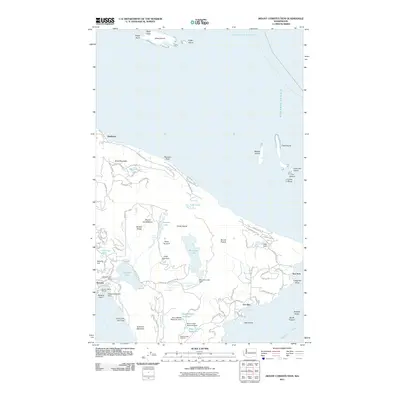
2011 Map of Mount Constitution
USGS Topo · Published 2011About this map
Mount Constitution towers over the eastern heart of Orcas Island, anchoring a landscape defined by dramatic elevation changes and freshwater lakes perched high above the Rosario Strait. The area around Rosario showcases a cluster of maritime and recreational infrastructure, including the Rosario Resort Marina and Rosario Seaplane Base on the shores of East Sound. The interior is heavily marked by a network of water management and natural falls, with the Boyd Lower Reservoir and Boyd Middle Reservoir systems situated south of Mountain Lake. Multiple cataracts like Cavern Falls and Rustic Falls emphasize the steep drainage patterns of Cascade Creek as it flows toward the sound. On the eastern coast, the settlement of Doe Bay and the nearby Olga-Doe Bay Cemetery provide significant points of interest for genealogists and local historians, while the offshore Peapod Rocks and Doe Island mark the transition into the deeper waters of the strait.
Find a feature on this map
101 named features on this map. Tap any name to fly to it.
Don’t see what you’re looking for? This feature index may not catch every label — zoom into the map to look around manually.
Map Details
Editions of this 2011 Mount Constitution Map
This is the sole edition of this map. No revisions or reprints were ever made.
Other maps of this area

1907 · Blaine
USGS Topo · 1:62,500

1943 · Orcas Island
USGS Topo · 1:62,500

1943 · Anacortes
USGS Topo · 1:62,500

1951 · Anacortes
USGS Topo · 1:62,500

1952 · Lummi Bay
USGS Topo · 1:24,000

1952 · Blaine
USGS Topo · 1:62,500

1957 · Orcas Island
USGS Topo · 1:62,500

1957 · Victoria
USGS Topo · 1:250,000

1973 · Cypress Island
USGS Topo · 1:24,000

1973 · Sucia Island
USGS Topo · 1:24,000