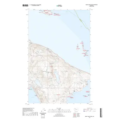
2020 Map of Mount Constitution
USGS Topo · Published 2020About this map
Orcas Island dominates this northern archipelago landscape, rising toward the prominent heights of Mt Constitution and Mt Pickett. This interior upland is characterized by a high-altitude freshwater system, including Mountain Lake, Twin Lakes, and Summit Lake, which eventually feed the Cascade Creek drainage. The coastal perimeter is defined by small, distinct communities such as Buckhorn on the northern shore and Doe Bay to the southeast, while the Olga-Doe Bay Cemetery serves as a central genealogical anchor for the area's local history.
Find a feature on this map
97 named features on this map. Tap any name to fly to it.
Don’t see what you’re looking for? This feature index may not catch every label — zoom into the map to look around manually.
Map Details
Editions of this 2020 Mount Constitution Map
This is the sole edition of this map. No revisions or reprints were ever made.
Other maps of this area

1907 · Blaine
USGS Topo · 1:62,500

1943 · Orcas Island
USGS Topo · 1:62,500

1943 · Anacortes
USGS Topo · 1:62,500

1951 · Anacortes
USGS Topo · 1:62,500

1952 · Lummi Bay
USGS Topo · 1:24,000

1952 · Blaine
USGS Topo · 1:62,500

1957 · Orcas Island
USGS Topo · 1:62,500

1957 · Victoria
USGS Topo · 1:250,000

1973 · Cypress Island
USGS Topo · 1:24,000

1973 · Sucia Island
USGS Topo · 1:24,000