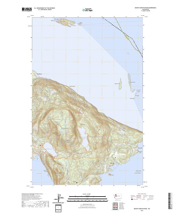
2023 Map of Mount Constitution
USGS Topo · Published 2023About this map
Orcas Island rises sharply from the Rosario Strait in this detailed look at the northeastern San Juan Islands. The landscape is dominated by the height of Mt Constitution and Mt Pickett, with deep freshwater bodies like Mountain Lake and Cascade Lake tucked into the high elevations. The coastal character of the island is defined by small settlements and landings, including Buckhorn on the north shore and Doe Bay to the southeast. Genealogists will find the Olga Doe Bay Cem situated near the south shore, while the map also captures numerous offshore landforms within the San Juan Islands National Wildlife Refuge, such as Puffin Island and The Sisters. Local naming conventions are evident in features like Chin-Chin-Tse-Tung and Kangaroo Point, reflecting the unique cultural and natural history of this maritime environment.
Find a feature on this map
99 named features on this map. Tap any name to fly to it.
Don’t see what you’re looking for? This feature index may not catch every label — zoom into the map to look around manually.
Map Details
Editions of this 2023 Mount Constitution Map
This is the sole edition of this map. No revisions or reprints were ever made.
Other maps of this area

1907 · Blaine
USGS Topo · 1:62,500

1943 · Orcas Island
USGS Topo · 1:62,500

1943 · Anacortes
USGS Topo · 1:62,500

1951 · Anacortes
USGS Topo · 1:62,500

1952 · Lummi Bay
USGS Topo · 1:24,000

1952 · Blaine
USGS Topo · 1:62,500

1957 · Orcas Island
USGS Topo · 1:62,500

1957 · Victoria
USGS Topo · 1:250,000

1973 · Cypress Island
USGS Topo · 1:24,000

1973 · Sucia Island
USGS Topo · 1:24,000