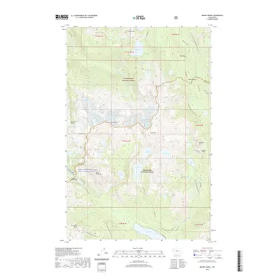
2020 Map of Mount Daniel
USGS Topo · Published 2020About this map
Snoqualmie National Forest and Wenatchee National Forest converge at the crest of the Cascades, where this 2020 survey records a high-altitude landscape of jagged peaks and alpine basins. The prominent massif of Mt Daniel dominates the center of the sheet, surrounded by significant glacial features and numerous high-country water bodies including Spade Lake, Marmot Lake, and Jade Lake. This map captures the intricate network of mountain passes that have long dictated travel through the region, from the northern Deception Pass to the southern Dutch Miller Gap. The Pacific Crest National Scenic Trail winds through the eastern and southern portions of the quadrangle, passing through Spinola Meadow and beneath Cathedral Rock. The boundary between King and Kittitas counties follows the primary drainage divide, separating the headwaters of the Cle Elum River from the E Fork Foss River and the Middle Fork Snoqualmie Wild and Scenic River.
Find a feature on this map
61 named features on this map. Tap any name to fly to it.
Don’t see what you’re looking for? This feature index may not catch every label — zoom into the map to look around manually.
Map Details
Editions of this 2020 Mount Daniel Map
This is the sole edition of this map. No revisions or reprints were ever made.
Other maps of this area

1901 · Snoqualmie Pass
USGS Topo · 1:125,000

1902 · Skykomish
USGS Topo · 1:125,000

1903 · Snoqualmie
USGS Topo · 1:125,000

1905 · Skykomish
USGS Topo · 1:125,000

1957 · Wenatchee
USGS Topo · 1:250,000

1961 · Snoqualmie Pass
USGS Topo · 1:62,500

1961 · Kachess Lake
USGS Topo · 1:62,500

1965 · Stevens Pass
USGS Topo · 1:24,000

1965 · Mount Daniel
USGS Topo · 1:24,000

1965 · Skykomish
USGS Topo · 1:24,000