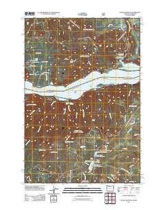
2011 Map of Mount Defiance
USGS Topo · Published 2011About this map
Mount Defiance towers over the Columbia River Gorge in this 2011 survey, marking a landscape defined by dramatic elevation changes and a complex water management network. On the northern bank, the settlement of Cook sits near the Little White Salmon National Fish Hatchery, where the Little White Salmon Fish Hatchery Reservoir and Little White Salmon Hatchery Dam support local operations. The terrain is notably steep, rising from the riverbanks to summits like Dog Mountain, which features the Dog Mountain Lookout, and the high ground of Augspurger Mountain.
Find a feature on this map
60 named features on this map. Tap any name to fly to it.
Don’t see what you’re looking for? This feature index may not catch every label — zoom into the map to look around manually.
Map Details
Editions of this 2011 Mount Defiance Map
This is the sole edition of this map. No revisions or reprints were ever made.
Other maps of this area

1926 · Hood River
USGS Topo · 1:125,000

1929 · Hood River
USGS Topo · 1:125,000

1953 · The Dalles
USGS Topo · 1:250,000

1956 · The Dalles
USGS Topo · 1:250,000

1957 · The Dalles
USGS Topo · 1:250,000

1957 · Bonneville Dam
USGS Topo · 1:62,500

1957 · Wind River
USGS Topo · 1:62,500

1957 · Willard
USGS Topo · 1:62,500

1957 · Hood River
USGS Topo · 1:62,500
1974 · Parkdale
USGS Topo · 1:24,000