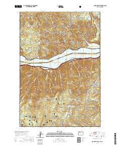
2020 Map of Mount Defiance
USGS Topo · Published 2020About this map
Mill A and the nearby flats of Mill A Flat and Mill B Flat anchor the northern landscape of this Columbia River Gorge corridor. The terrain is defined by the steep elevation change from the shores of Lake Bonneville up to the high peaks of Mt Defiance and Shellrock Mtn. This area serves as a critical junction for water management and conservation, featuring the Little White Salmon National Fish Hatchery near Drano Lake and the Green Point Lower Reservoir to the south. The mapping detail shows a dense network of mountain hydrology, from the cascading Lancaster Falls and Starvation Creek Falls to alpine water bodies like Warren Lake and Bear Lake. These features reflect a landscape heavily shaped by the boundaries of the Gifford Pinchot National Forest and Mount Hood National Forest, where timber history and watershed protection intersect.
Find a feature on this map
60 named features on this map. Tap any name to fly to it.
Don’t see what you’re looking for? This feature index may not catch every label — zoom into the map to look around manually.
Map Details
Editions of this 2020 Mount Defiance Map
This is the sole edition of this map. No revisions or reprints were ever made.
Other maps of this area

1926 · Hood River
USGS Topo · 1:125,000

1929 · Hood River
USGS Topo · 1:125,000

1953 · The Dalles
USGS Topo · 1:250,000

1956 · The Dalles
USGS Topo · 1:250,000

1957 · The Dalles
USGS Topo · 1:250,000

1957 · Bonneville Dam
USGS Topo · 1:62,500

1957 · Wind River
USGS Topo · 1:62,500

1957 · Willard
USGS Topo · 1:62,500

1957 · Hood River
USGS Topo · 1:62,500
1974 · Parkdale
USGS Topo · 1:24,000