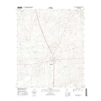
2016 Map of Mount Enterprise
USGS Topo · Published 2016About this map
Mount Enterprise sits at a crossroads of East Texas history, where the headwaters of the E Fork Angelina River and numerous creeks like Ham Cr and Griffin Br create a densely hydrated landscape. The town's grid is clearly defined by local thoroughfares such as W Rusk St and Railroad St, reflecting its development around early transportation corridors. This area in Rusk County is particularly significant for genealogists due to the high density of family and community burial grounds, including the Barker Family Cem, Edmonson Cem, and Ross Cem. The eastern portion of the quadrangle is defined by the winding course of the Attoyac River, while to the west, landmarks like Boles Lake and Jones Lake punctuate the terrain. The map also records numerous local arteries, such as Gatlin Rd and FM 2496, which connect the town to surrounding homesteads and natural features like Gum Springs Br and Clear Br.
Find a feature on this map
105 named features on this map. Tap any name to fly to it.
Don’t see what you’re looking for? This feature index may not catch every label — zoom into the map to look around manually.
Map Details
Editions of this 2016 Mount Enterprise Map
This is the sole edition of this map. No revisions or reprints were ever made.
Other maps of this area

1935 · Henderson
USGS Topo · 1:48,000

1939 · Henderson
USGS Topo · 1:62,500

1943 · Cushing
USGS Topo · 1:62,500

1945 · Cushing
USGS Topo · 1:62,500

1953 · Palestine
USGS Topo · 1:250,000

1956 · Tyler
USGS Topo · 1:250,000

1957 · Palestine
USGS Topo · 1:250,000

1960 · Minden
USGS Topo · 1:62,500

1960 · Mount Enterprise
USGS Topo · 1:62,500

1973 · Cushing
USGS Topo · 1:24,000