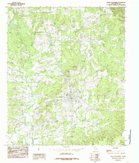
1984 Map of Mount Enterprise
USGS Topo · Published 1985About this map
Mount Enterprise sits at the heart of this Rusk County landscape, characterized by its position among the headwaters and numerous tributaries that define the local topography. In the early 1980s, the town's layout was intersected by several prominent waterways, including Gatlin Branch and Neal Branch, which flow through the immediate vicinity of the settlement. To the northwest, Lookout Mountain rises as a notable geographic landmark, while the southwestern portion of the sheet is dominated by the upper reaches of the Angelina River and its East Fork.
Find a feature on this map
35 named features on this map. Tap any name to fly to it.
Don’t see what you’re looking for? This feature index may not catch every label — zoom into the map to look around manually.
Map Details
Editions of this 1984 Mount Enterprise Map
This is the sole edition of this map. No revisions or reprints were ever made.
Other maps of this area

1935 · Henderson
USGS Topo · 1:48,000

1939 · Henderson
USGS Topo · 1:62,500

1943 · Cushing
USGS Topo · 1:62,500

1945 · Cushing
USGS Topo · 1:62,500

1953 · Palestine
USGS Topo · 1:250,000

1956 · Tyler
USGS Topo · 1:250,000

1957 · Palestine
USGS Topo · 1:250,000

1960 · Minden
USGS Topo · 1:62,500

1960 · Mount Enterprise
USGS Topo · 1:62,500

1973 · Cushing
USGS Topo · 1:24,000