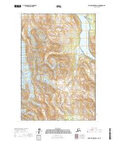
2017 Map of Mount Fairweather C-2 NW
USGS Topo · Published 2017About this map
Glacier Bay National Park encompasses most of this landscape, where massive ice flows and high ridges meet the coastal waters of Charpentier Inlet. The topographical survey highlights the dramatic verticality of the terrain, rising from the shoreline to prominent summits like Gullied Peak and Red Bed Peak. Glacial activity is a defining characteristic of the geography, with Charpentier Glacier and Maynard Glacier occupying deep valleys carved into the surrounding mountains. Notable ridgelines such as Goat Ridge and Enigma Ridge divide the icy basins, providing a clear record of the area's geological composition during this contemporary era. The map traces the intersection of glacial recession and coastal geomorphology, essential for understanding the shifting environment of this protected wilderness.
Find a feature on this map
14 named features on this map. Tap any name to fly to it.
Don’t see what you’re looking for? This feature index may not catch every label — zoom into the map to look around manually.
Map Details
Editions of this 2017 Mount Fairweather C-2 NW Map
This is the sole edition of this map. No revisions or reprints were ever made.
Other maps of this area

1948 · Mount Fairweather D-2
USGS Topo · 1:63,360

1948 · Mount Fairweather C-2
USGS Topo · 1:63,360

1950 · Mount Fairweather D-2
USGS Topo · 1:63,360

1950 · Mount Fairweather C-2
USGS Topo · 1:63,360

1951 · Mt Fairweather
USGS Topo · 1:250,000

1961 · Mount Fairweather C-3
USGS Topo · 1:63,360

1961 · Mount Fairweather D-3
USGS Topo · 1:63,360

1961 · Mt Fairweather
USGS Topo · 1:250,000
2017 · Mount Fairweather C-3 SE
USGS Topo · 1:25,000
2017 · Mount Fairweather D-2 SW
USGS Topo · 1:25,000