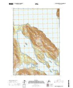
2017 Map of Mount Fairweather D-2 SW
USGS Topo · Published 2017About this map
Gilbert Peninsula dominates the central portion of this 2017 survey, a massive landform projecting into the waters of Glacier Bay. This landscape is contained entirely within Glacier Bay National Park, where the relationship between the sea and the glaciated terrain is clearly visible through detailed bathymetry and elevation data. The map reveals the intricate coastline of Scidmore Bay and the northern reaches of Charpentier Inlet, showcasing a wilderness shaped by tectonic and glacial forces. The absence of roads or permanent settlements emphasizes the protected nature of this region in the Hoonah-Angoon Census Area, serving as a modern record of the shoreline and maritime boundaries before further environmental changes occur.
Find a feature on this map
11 named features on this map. Tap any name to fly to it.
Don’t see what you’re looking for? This feature index may not catch every label — zoom into the map to look around manually.
Map Details
Editions of this 2017 Mount Fairweather D-2 SW Map
This is the sole edition of this map. No revisions or reprints were ever made.
Other maps of this area

1948 · Mount Fairweather D-2
USGS Topo · 1:63,360

1948 · Mount Fairweather C-2
USGS Topo · 1:63,360

1950 · Mount Fairweather D-2
USGS Topo · 1:63,360

1950 · Mount Fairweather C-2
USGS Topo · 1:63,360

1951 · Mt Fairweather
USGS Topo · 1:250,000

1961 · Mount Fairweather C-3
USGS Topo · 1:63,360

1961 · Mount Fairweather D-3
USGS Topo · 1:63,360

1961 · Mt Fairweather
USGS Topo · 1:250,000
2017 · Mount Fairweather D-2 NE
USGS Topo · 1:25,000
2017 · Mount Fairweather C-2 NW
USGS Topo · 1:25,000