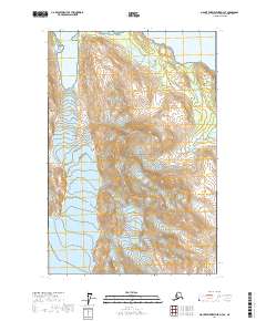
2017 Map of Mount Fairweather D-3 SE
USGS Topo · Published 2017About this map
Glacier Bay National Park dominates this topographic survey, illustrating a landscape of massive ice flows and deep coastal inlets. The convergence of the Saint Elias Mountains and the Fairweather Range creates a complex system of high peaks and glacial valleys. Of particular interest is the drainage of the Reid Glacier into Reid Inlet, and the proximity of the Lamplugh Glacier to the western edge of the quadrangle. These features document the dramatic ice-and-water interface of the Alaskan coast. The map also traces the Scidmore Glacier as it moves toward the waters of Glacier Bay, providing a technical look at the landform elevations and hydrography of this protected wilderness during the early 21st century.
Find a feature on this map
14 named features on this map. Tap any name to fly to it.
Don’t see what you’re looking for? This feature index may not catch every label — zoom into the map to look around manually.
Map Details
Editions of this 2017 Mount Fairweather D-3 SE Map
This is the sole edition of this map. No revisions or reprints were ever made.
Other maps of this area

1948 · Mount Fairweather D-2
USGS Topo · 1:63,360

1948 · Mount Fairweather C-2
USGS Topo · 1:63,360

1950 · Mount Fairweather D-2
USGS Topo · 1:63,360

1950 · Mount Fairweather C-2
USGS Topo · 1:63,360

1951 · Mt Fairweather
USGS Topo · 1:250,000

1961 · Mount Fairweather C-3
USGS Topo · 1:63,360

1961 · Mount Fairweather D-3
USGS Topo · 1:63,360

1961 · Mt Fairweather
USGS Topo · 1:250,000
2017 · Mount Fairweather C-3 NW
USGS Topo · 1:25,000
2017 · Mount Fairweather C-2 NW
USGS Topo · 1:25,000