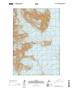
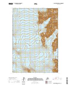
2017 Map of Mount Fairweather C-3 NW
USGS Topo · Published 2017About this map
Glacier Bay National Park dominates this landscape, where the sheer scale of the glacial systems and coastal mountains defines the terrain. The northern reaches are characterized by the massive flows of Johns Hopkins Glacier and Lamplugh Glacier, while Reid Glacier carves through the central portion of the quadrangle. These frozen rivers illustrate the ongoing geomorphological changes in southeast Alaska, revealing how ice has shaped the fjords and inlets over millennia.
Find a feature on this map
11 named features on this map. Tap any name to fly to it.
Don’t see what you’re looking for? This feature index may not catch every label — zoom into the map to look around manually.
Map Details
Editions of this 2017 Mount Fairweather C-3 NW Map
This is the sole edition of this map. No revisions or reprints were ever made.
Other maps of this area

1951 · Mt Fairweather
USGS Topo · 1:250,000

1961 · Mount Fairweather D-4
USGS Topo · 1:63,360

1961 · Mount Fairweather C-4
USGS Topo · 1:63,360

1961 · Mount Fairweather C-3
USGS Topo · 1:63,360

1961 · Mount Fairweather D-3
USGS Topo · 1:63,360

1961 · Mt Fairweather
USGS Topo · 1:250,000
2017 · Mount Fairweather C-4 SE
USGS Topo · 1:25,000
2017 · Mount Fairweather D-4 SE
USGS Topo · 1:25,000
2017 · Mount Fairweather C-4 NE
USGS Topo · 1:25,000
2017 · Mount Fairweather C-3 SE
USGS Topo · 1:25,000