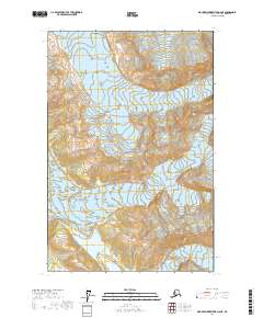
2017 Map of Mount Fairweather D-6 NE
USGS Topo · Published 2017About this map
Glacier Bay National Park dominates this terrain, representing a wilderness defined by its massive moving ice and high-elevation topography. The map illustrates the convergence of two significant ice features: the Grand Plateau Glacier to the north and the Sea Otter Glacier further south. These glaciers are part of a larger interconnected icefield system that continues to shape the coast of Yakutat City and Borough. Detailed contour lines reveal the sheer verticality of the surrounding peaks, illustrating how the glacial flow is channeled through high mountain passes before descending toward the Pacific. The lack of human infrastructure or established trails reflects the primitive state of this protected landscape, where the primary narrative is one of geological and glaciological change rather than human settlement.
Find a feature on this map
7 named features on this map. Tap any name to fly to it.
Don’t see what you’re looking for? This feature index may not catch every label — zoom into the map to look around manually.
Map Details
Editions of this 2017 Mount Fairweather D-6 NE Map
This is the sole edition of this map. No revisions or reprints were ever made.
Other maps of this area

1951 · Mt Fairweather
USGS Topo · 1:250,000

1952 · Skagway
USGS Topo · 1:250,000

1961 · Mount Fairweather D-6
USGS Topo · 1:63,360

1961 · Mount Fairweather D-5
USGS Topo · 1:63,360

1961 · Skagway A-8
USGS Topo · 1:63,360

1961 · Mt Fairweather
USGS Topo · 1:250,000

1961 · Skagway
USGS Topo · 1:250,000
2017 · Mount Fairweather D-6 SW
USGS Topo · 1:25,000
2017 · Mount Fairweather D-5 NW
USGS Topo · 1:25,000
2017 · Mount Fairweather D-6 SE
USGS Topo · 1:25,000