
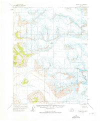
1961 Map of Skagway A-8
USGS Topo · Published 1966About this map
Alsek Glacier and Grand Plateau Glacier dominate this 1:63,360 scale survey of the Alaskan coast. This topographic study reflects the work of the U.S. Geological Survey using photogrammetric methods from aerial photographs taken in 1948 and 1954, then field-annotated in 1961. The map is defined by its dramatic ice-bound landscape, where the shifting topography is noted by numerous crevasses across the glacial bodies. While the terrain remains largely unmarked by human infrastructure, the map serves as a critical baseline for glaciologists and researchers tracking the historical extent of ice fields in the mid-twentieth century. The absence of roads or trails highlights the isolation of this corner of Alaska before more modern surveying and mapping methods were applied.
Find a feature on this map
3 named features on this map. Tap any name to fly to it.
Don’t see what you’re looking for? This feature index may not catch every label — zoom into the map to look around manually.
Map Details
Editions of this 1961 Skagway A-8 Map
2 editions found
Other maps of this area

1951 · Yakutat
USGS Topo · 1:250,000

1951 · Mt Fairweather
USGS Topo · 1:250,000

1952 · Skagway
USGS Topo · 1:250,000

1959 · Yakutat A-1
USGS Topo · 1:63,360

1959 · Yakutat B-1
USGS Topo · 1:63,360

1959 · Yakutat
USGS Topo · 1:250,000
1961 · Mount Fairweather D-7
USGS Topo · 1:63,360

1961 · Skagway A-7
USGS Topo · 1:63,360

1961 · Mount Fairweather D-6
USGS Topo · 1:63,360

1961 · Mount Fairweather D-5
USGS Topo · 1:63,360