
1961 Map of Skagway A-7
USGS Topo · Published 1966About this map
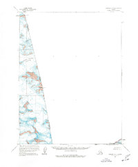
Grand Pacific Glacier dominates the northern reaches of this coastal Alaskan landscape, marking a dynamic frozen boundary between the Alaska British Columbia border and the heights of the Fairweather Range. Based on photogrammetric data from the late 1940s and mid-1950s, the map reveals the massive ice fields and high peaks that define the region's geography, including Mt Watson and Mt Hay. The southern portion of this sliver of terrain falls within the Glacier Bay Nat Monument, where the international border is demarcated by a series of high-altitude landmarks such as Boundary Peak 167 and Boundary Peak 166. The presence of numerous Crevasses indicated across the ice sheets provides a technical look at the hazardous glacial environment as it was recorded during this mid-century survey.
Find a feature on this map
12 named features on this map. Tap any name to fly to it.
Don’t see what you’re looking for? This feature index may not catch every label — zoom into the map to look around manually.
Map Details
Editions of this 1961 Skagway A-7 Map
2 editions found
Other maps of this area

1951 · Mt Fairweather
USGS Topo · 1:250,000

1952 · Skagway
USGS Topo · 1:250,000

1961 · Mount Fairweather D-4
USGS Topo · 1:63,360
1961 · Skagway A-6
USGS Topo · 1:63,360

1961 · Mount Fairweather D-5
USGS Topo · 1:63,360
1961 · Skagway B-8
USGS Topo · 1:63,360

1961 · Skagway A-8
USGS Topo · 1:63,360

1961 · Mt Fairweather
USGS Topo · 1:250,000

1961 · Skagway
USGS Topo · 1:250,000
2017 · Mount Fairweather D-5 NW
USGS Topo · 1:25,000