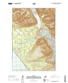
2017 Map of Mount Fairweather D-6 NW
USGS Topo · Published 2017About this map
Glacier Bay National Park dominates this coastal survey, where the glacial landscape meets the open waters of the Gulf of Alaska. The terrain is characterized by massive ice fields and the dramatic transitions of the Grand Plateau Glacier and Sea Otter Glacier. This area, managed under the Public Land Survey System as Townships t34s r45e and t35s r45e, showcases the raw topographical shifts where ice gives way to the sea. Notable landforms like Desolation Valley and the drainage of Sea Otter Cr illustrate the dynamic hydrography of the Yakutat region. The map provides a high-resolution 2017 record of these ice margins, essential for tracking the shifting footprint of glaciers within the national park system.
Find a feature on this map
10 named features on this map. Tap any name to fly to it.
Don’t see what you’re looking for? This feature index may not catch every label — zoom into the map to look around manually.
Map Details
Editions of this 2017 Mount Fairweather D-6 NW Map
This is the sole edition of this map. No revisions or reprints were ever made.
Other maps of this area

1951 · Yakutat
USGS Topo · 1:250,000

1951 · Mt Fairweather
USGS Topo · 1:250,000

1952 · Skagway
USGS Topo · 1:250,000

1959 · Yakutat A-1
USGS Topo · 1:63,360

1959 · Yakutat
USGS Topo · 1:250,000
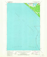
1961 · Mount Fairweather D-7
USGS Topo · 1:63,360

1961 · Mount Fairweather D-6
USGS Topo · 1:63,360

1961 · Skagway A-8
USGS Topo · 1:63,360

1961 · Mt Fairweather
USGS Topo · 1:250,000

1961 · Skagway
USGS Topo · 1:250,000