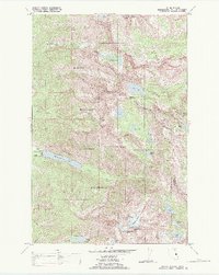
1988 Map of Mount Harding
USGS Topo · Published 1988About this map
Mission Mountains peaks dominate this high-altitude landscape within the Flathead Indian Reservation Boundary. The terrain is defined by extreme relief, stretching from the ice of McDonald Glacier near the summit of McDonald Peak down to the shores of McDonald Lake. This 1988 revision, based on earlier surveys and Bureau of Indian Affairs data, highlights a primitive area managed as the Tribal Wilderness. Movement through these heights is restricted to traditional routes like the Mollman Pack Trail, which connects remote basins such as Mollman Lakes and Crow Creek Lakes. The drainage patterns are complex, with waters flowing from high alpine sources like Summit Lake into the North Fork Elk Creek and Post Creek, illustrating the vital watershed role this protected mountain range plays for the surrounding Flathead Agency lands.
Find a feature on this map
38 named features on this map. Tap any name to fly to it.
Don’t see what you’re looking for? This feature index may not catch every label — zoom into the map to look around manually.
Map Details
Editions of this 1988 Mount Harding Map
This is the sole edition of this map. No revisions or reprints were ever made.
Other maps of this area

1920 · Flathead Lake
USGS Topo · 1:125,000

1921 · Elbow Lake
USGS Topo · 1:125,000

1955 · Choteau
USGS Topo · 1:250,000

1956 · Wallace
USGS Topo · 1:250,000

1957 · Choteau
USGS Topo · 1:250,000

1958 · Choteau
USGS Topo · 1:250,000

1960 · Wallace
USGS Topo · 1:250,000

1962 · Choteau
USGS Topo · 1:250,000

1964 · Fort Connah
USGS Topo · 1:24,000

1964 · Ronan
USGS Topo · 1:24,000