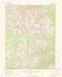
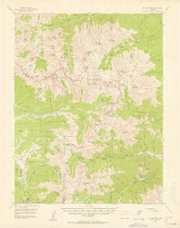
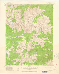
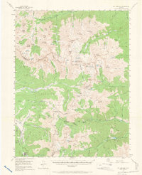
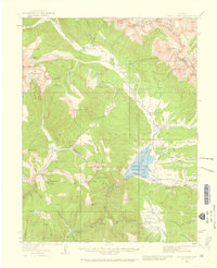
1955 Map of Mount Harvard
USGS Topo · Published 1972About this map
Winfield and Vicksburg anchor the upper reaches of Clear Creek in this mid-century look at the high Sawatch Range. The map details a landscape defined by the legacies of late-19th-century silver and gold extraction, with many settlements showing the quiet footprint of early mining camps that had transitioned into seasonal or remote outposts by the 1950s. High-altitude mining operations such as the Banker Mine and the Silver King Mine are positioned near the Continental Divide, which zigzags through the center of the quadrangle.
Find a feature on this map
101 named features on this map. Tap any name to fly to it.
Don’t see what you’re looking for? This feature index may not catch every label — zoom into the map to look around manually.
Map Details
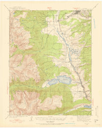
Editions of this 1955 Mount Harvard Map
4 editions found
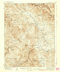
Other maps of this area

1889 · Leadville
USGS Topo · 1:125,000

1891 · Leadville
USGS Topo · 1:125,000

1909 · Mount Jackson
USGS Topo · 1:125,000

1911 · Mount Jackson
USGS Topo · 1:125,000
1934 · Taylor Park
USGS Topo · 1:62,500
1935 · Mount Elbert
USGS Topo · 1:62,500
1937 · Taylor Park
USGS Topo · 1:62,500

1938 · Mount Elbert
USGS Topo · 1:62,500

1939 · Mount Elbert
USGS Topo · 1:62,500

1940 · Garfield
USGS Topo · 1:62,500