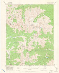
1955 Map of Mount Harvard
USGS Topo · Published 1965About this map
The high alpine country of the Sawatch Range dominates this mid-century survey, centered on the towering peaks of the Collegiate Range. Gold and silver mining history is etched into the landscape, evidenced by the presence of the Banker Mine near Winfield and the Magdalene Mine in the Magdalene Gulch. These high-altitude settlements and camps were connected by a network of trails and primitive roads, including the Main Range Trail and the route to Tincup at the southern edge. The map captures the remote character of the Gunnison National Forest before modern recreation infrastructure was fully established. Names like Hangmans Cabin and Halfway Station point to the rugged transit history of the area, while the soaring summits of Mt Harvard and Mt Yale define the hydrological divide between the Gunnison and Chaffee county lines.
Find a feature on this map
116 named features on this map. Tap any name to fly to it.
Don’t see what you’re looking for? This feature index may not catch every label — zoom into the map to look around manually.
Map Details
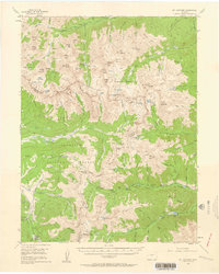
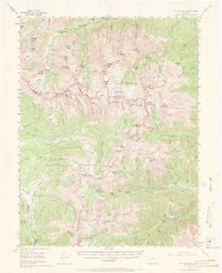
Editions of this 1955 Mount Harvard Map
4 editions found

Other maps of this area

1889 · Leadville
USGS Topo · 1:125,000

1891 · Leadville
USGS Topo · 1:125,000

1909 · Mount Jackson
USGS Topo · 1:125,000

1911 · Mount Jackson
USGS Topo · 1:125,000

1934 · Taylor Park
USGS Topo · 1:62,500

1935 · Mount Elbert
USGS Topo · 1:62,500

1937 · Taylor Park
USGS Topo · 1:62,500

1938 · Mount Elbert
USGS Topo · 1:62,500

1939 · Mount Elbert
USGS Topo · 1:62,500

1940 · Garfield
USGS Topo · 1:62,500