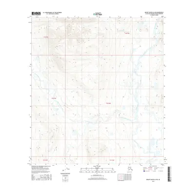
2016 Map of Mount Hayes A-6 NE
USGS Topo · Published 2016About this map
The Maclaren River and its complex glacial drainage patterns dominate this remote Alaskan landscape within the Matanuska-Susitna Borough. This 2016 survey highlights the intricate network of the West Fork Maclaren River as it weaves through a basin marked by numerous small kettle lakes and tributaries. Higher elevations are characterized by named water bodies such as Hidden Lake in the north and Petrokov Lake to the east, while Glaser Lake sits tucked near the western edge of the quadrangle. The hydrology of the region is further defined by Cottonwood Creek and Boulder Creek, illustrating the raw natural state of this subarctic wilderness. These drainages provide a clear record of the watershed's topography as it existed in the early twenty-first century, largely untouched by permanent settlements or roads.
Find a feature on this map
14 named features on this map. Tap any name to fly to it.
Don’t see what you’re looking for? This feature index may not catch every label — zoom into the map to look around manually.
Map Details
Editions of this 2016 Mount Hayes A-6 NE Map
This is the sole edition of this map. No revisions or reprints were ever made.
Other maps of this area

1949 · Mount Hayes A-5
USGS Topo · 1:63,360

1950 · Mount Hayes
USGS Topo · 1:250,000

1950 · Mount Hayes A-6
USGS Topo · 1:63,360

1951 · Mount Hayes
USGS Topo · 1:250,000

1951 · Mount Hayes B-6
USGS Topo · 1:63,360

1951 · Mt. Hayes B-5
USGS Topo · 1:63,360

1952 · Mount Hayes A-6
USGS Topo · 1:63,360
1952 · Mount Hayes A-5
USGS Topo · 1:63,360

1955 · Mount Hayes
USGS Topo · 1:250,000
2016 · Mount Hayes A-6 NW
USGS Topo · 1:25,000