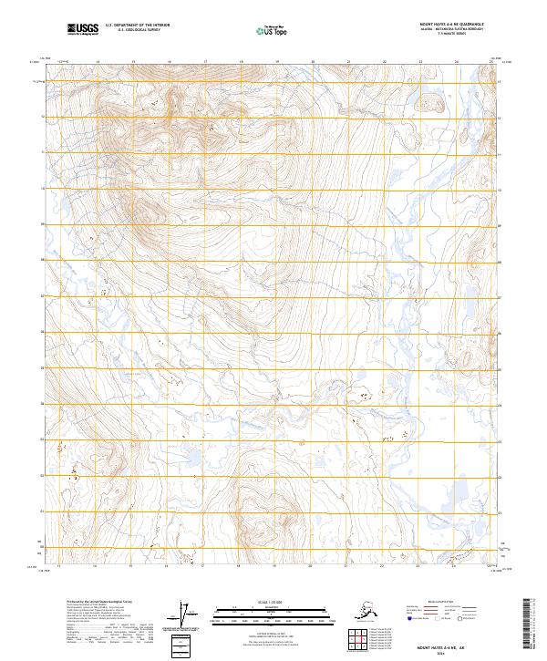
2024 Map of Mount Hayes A-6 NE
USGS Topo · Published 2024About this map
The Maclaren River and its major tributaries dominate this high-altitude landscape in the Matanuska-Susitna region. The West Fork Maclaren River cuts a significant path across the terrain, converging toward the main channel in a complex system of glacial drainage. High-elevation water bodies like Glaser Lake are primary landmarks in an area defined by sharp topographic relief and the absence of permanent human settlements or road infrastructure. The drainage network is further defined by Cottonwood Creek to the north and Boulder Creek in the southeastern corner. This survey highlights the intricate hydrology of the Alaska Range's southern slopes, where seasonal meltwater patterns dictate the land's character.
Find a feature on this map
11 named features on this map. Tap any name to fly to it.
Don’t see what you’re looking for? This feature index may not catch every label — zoom into the map to look around manually.
Map Details
Editions of this 2024 Mount Hayes A-6 NE Map
This is the sole edition of this map. No revisions or reprints were ever made.
Other maps of this area

1949 · Mount Hayes A-5
USGS Topo · 1:63,360

1950 · Mount Hayes
USGS Topo · 1:250,000

1950 · Mount Hayes A-6
USGS Topo · 1:63,360

1951 · Mount Hayes
USGS Topo · 1:250,000

1951 · Mount Hayes B-6
USGS Topo · 1:63,360

1951 · Mt. Hayes B-5
USGS Topo · 1:63,360

1952 · Mount Hayes A-6
USGS Topo · 1:63,360
1952 · Mount Hayes A-5
USGS Topo · 1:63,360

1955 · Mount Hayes
USGS Topo · 1:250,000
2016 · Mount Hayes A-6 NW
USGS Topo · 1:25,000