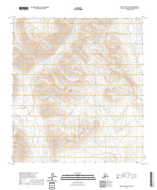
2024 Map of Mount Hayes A-6 NW
USGS Topo · Published 2024About this map
Clearwater Mountains dominate this high-altitude interior landscape in the Matanuska-Susitna Borough. The drainage pattern here is defined by numerous glacial-fed waterways, including the winding Clearwater Creek and Little Clearwater Creek which carve through the high-elevation valleys. Along the eastern edge of the survey area, the West Fork Maclaren River flows southward through a wide glacial valley. The map reveals the intricate natural topography of the Alaska Range's southern foothills, highlighting remote watercourses such as Coal Creek and Pass Creek. This map captures a pristine wilderness area where land use remains defined by its underlying geology and natural drainage systems, providing a detailed record of the terrain as it appeared in the early 21st century.
Find a feature on this map
12 named features on this map. Tap any name to fly to it.
Don’t see what you’re looking for? This feature index may not catch every label — zoom into the map to look around manually.
Map Details
Editions of this 2024 Mount Hayes A-6 NW Map
This is the sole edition of this map. No revisions or reprints were ever made.
Other maps of this area

1949 · Healy A-1
USGS Topo · 1:63,360

1950 · Mount Hayes
USGS Topo · 1:250,000

1950 · Healy B-1
USGS Topo · 1:63,360

1950 · Mount Hayes A-6
USGS Topo · 1:63,360

1951 · Healy
USGS Topo · 1:250,000

1951 · Mount Hayes
USGS Topo · 1:250,000

1951 · Mount Hayes B-6
USGS Topo · 1:63,360
1952 · Healy A-1
USGS Topo · 1:63,360

1952 · Healy B-1
USGS Topo · 1:63,360

1952 · Mount Hayes A-6
USGS Topo · 1:63,360