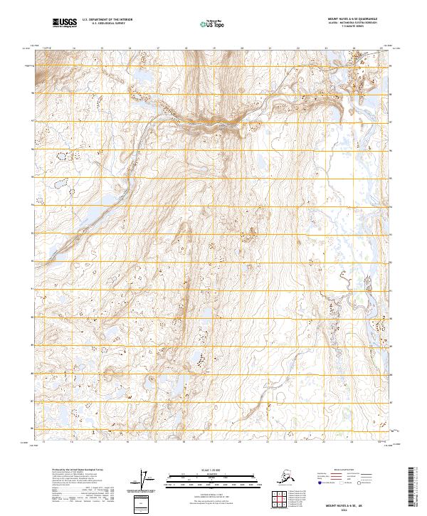
2024 Map of Mount Hayes A-6 SE
USGS Topo · Published 2024About this map
Crazy Notch forms a distinct topographical break in the high mountain landscape of this interior Alaska region. The Denali Highway winds through this pass, following a path shaped by the glacial history of the area. To the east, the Maclaren River cuts a wide valley through the terrain, fed by smaller tributaries like Osar Creek. The map detail reflects the expansive, high-altitude environment of the Matanuska-Susitna Borough, where transportation is dictated by the natural corridors of the mountain ranges. This 2024 survey captures the relationship between the primary gravel road artery and the shifting riverbeds and creek lines that characterize this subarctic wilderness.
Find a feature on this map
8 named features on this map. Tap any name to fly to it.
Don’t see what you’re looking for? This feature index may not catch every label — zoom into the map to look around manually.
Map Details
Editions of this 2024 Mount Hayes A-6 SE Map
This is the sole edition of this map. No revisions or reprints were ever made.
Other maps of this area

1949 · Mount Hayes A-5
USGS Topo · 1:63,360

1950 · Mount Hayes
USGS Topo · 1:250,000

1950 · Mount Hayes A-6
USGS Topo · 1:63,360

1951 · Gulkana
USGS Topo · 1:250,000

1951 · Mount Hayes
USGS Topo · 1:250,000

1951 · Gulkana D-6
USGS Topo · 1:63,360

1951 · Gulkana D-5
USGS Topo · 1:63,360
1952 · Gulkana D-6
USGS Topo · 1:63,360
1952 · Gulkana D-5
USGS Topo · 1:63,360

1952 · Mount Hayes A-6
USGS Topo · 1:63,360