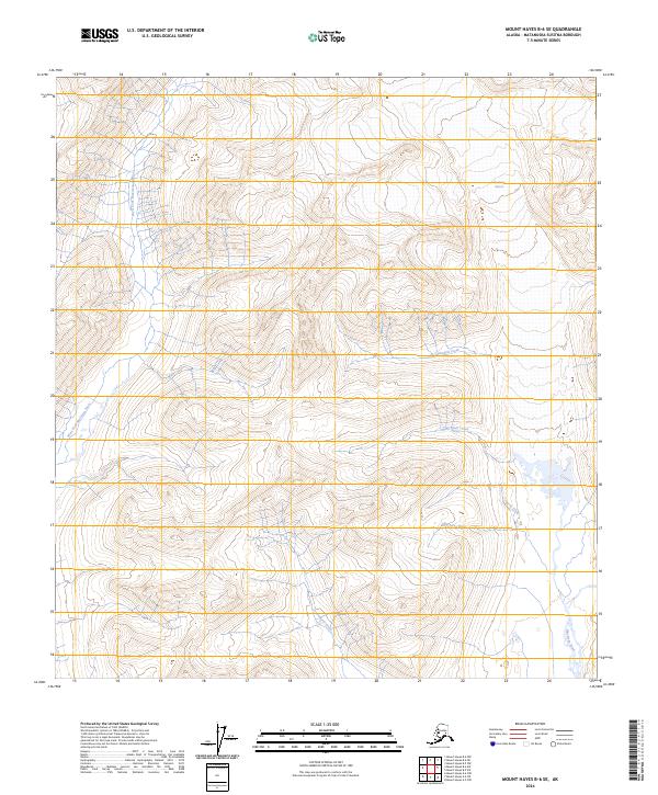
2024 Map of Mount Hayes B-6 SE
USGS Topo · Published 2024About this map
Maclaren Glacier feeds a complex network of glacial meltwater and drainage systems in this high-altitude Alaskan landscape. The West Fork Maclaren River and the main stem of the Maclaren River dominate the hydrology, carving through the terrain alongside significant tributaries like Cathedral Creek and Two Plate Creek. These watercourses illustrate the active geological process of glacial recession and the formation of braided river systems characteristic of the Matanuska-Susitna region.
Find a feature on this map
11 named features on this map. Tap any name to fly to it.
Don’t see what you’re looking for? This feature index may not catch every label — zoom into the map to look around manually.
Map Details
Editions of this 2024 Mount Hayes B-6 SE Map
This is the sole edition of this map. No revisions or reprints were ever made.
Other maps of this area

1949 · Mount Hayes A-5
USGS Topo · 1:63,360

1950 · Mount Hayes
USGS Topo · 1:250,000

1950 · Mount Hayes A-6
USGS Topo · 1:63,360

1951 · Mount Hayes
USGS Topo · 1:250,000

1951 · Mount Hayes B-6
USGS Topo · 1:63,360

1951 · Mt. Hayes B-5
USGS Topo · 1:63,360

1952 · Mount Hayes A-6
USGS Topo · 1:63,360
1952 · Mount Hayes A-5
USGS Topo · 1:63,360

1955 · Mount Hayes
USGS Topo · 1:250,000
2016 · Mount Hayes A-6 NW
USGS Topo · 1:25,000