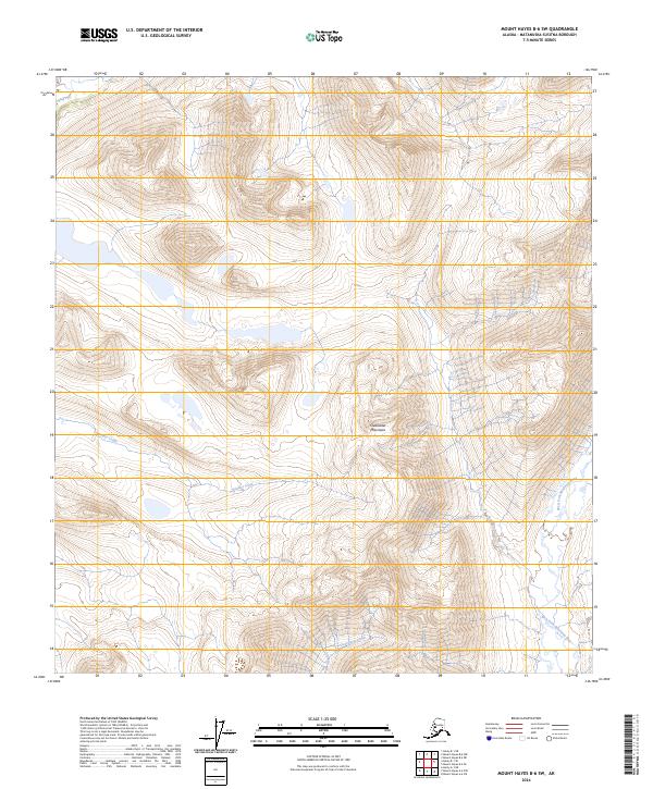
2024 Map of Mount Hayes B-6 SW
USGS Topo · Published 2024About this map
Clearwater Mountains dominate this high-altitude landscape in the Matanuska-Susitna region, where the terrain is defined by extreme relief and glacial drainage patterns. The drainage system is anchored by the West Fork Maclaren River along the eastern edge, while the interior is carved by Boulder Creek and Clearwater Creek. This 2024 map reflects a contemporary record of an uninhabited Alaskan wilderness, primarily utilized for its natural resources and as a corridor for back-country traversal. The Public Land Survey System grids, including t18s r4e and t19s r5e, provide the only human-imposed framework across these peaks and valleys, illustrating how modern cartography organizes even the most remote and roadless sections of the Alaskan interior.
Find a feature on this map
8 named features on this map. Tap any name to fly to it.
Don’t see what you’re looking for? This feature index may not catch every label — zoom into the map to look around manually.
Map Details
Editions of this 2024 Mount Hayes B-6 SW Map
This is the sole edition of this map. No revisions or reprints were ever made.
Other maps of this area

1949 · Healy A-1
USGS Topo · 1:63,360

1950 · Mount Hayes
USGS Topo · 1:250,000

1950 · Healy B-1
USGS Topo · 1:63,360

1950 · Mount Hayes A-6
USGS Topo · 1:63,360

1951 · Healy
USGS Topo · 1:250,000

1951 · Mount Hayes
USGS Topo · 1:250,000

1951 · Mount Hayes B-6
USGS Topo · 1:63,360
1952 · Healy A-1
USGS Topo · 1:63,360

1952 · Healy B-1
USGS Topo · 1:63,360

1952 · Mount Hayes A-6
USGS Topo · 1:63,360