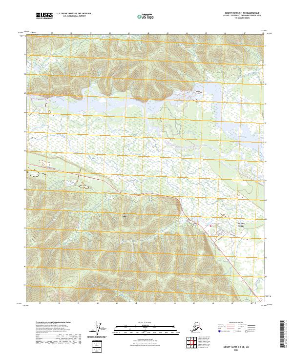
2024 Map of Mount Hayes C-1 NE
USGS Topo · Published 2024About this map
Dot Lake Village serves as a primary settlement hub along the Alaska Highway in this portion of the Southeast Fairbanks Census Area. The community is situated near the shores of Dot Lake, positioned south of the expansive Tanana River corridor. The local street network within the village includes residential corridors such as Luke Avenue, Vogle Avenue, and Miller Avenue, providing a detailed look at the rural layout and land use near the highway.
Find a feature on this map
18 named features on this map. Tap any name to fly to it.
Don’t see what you’re looking for? This feature index may not catch every label — zoom into the map to look around manually.
Map Details
Editions of this 2024 Mount Hayes C-1 NE Map
This is the sole edition of this map. No revisions or reprints were ever made.
Other maps of this area

1949 · Tanacross
USGS Topo · 1:250,000

1950 · Tanacross
USGS Topo · 1:250,000

1950 · Mount Hayes
USGS Topo · 1:250,000

1951 · Mount Hayes
USGS Topo · 1:250,000

1954 · Tanacross C-6
USGS Topo · 1:63,360

1954 · Mount Hayes D-1
USGS Topo · 1:63,360

1954 · Tanacross D-6
USGS Topo · 1:63,360

1954 · Mount Hayes C-1
USGS Topo · 1:63,360

1955 · Mount Hayes C-1
USGS Topo · 1:63,360
1955 · Tanacross C-6
USGS Topo · 1:63,360