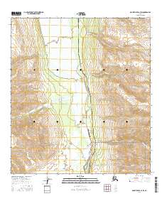
2016 Map of Mount Hayes C-4 SW
USGS Topo · Published 2016About this map
Delta River drainage dominates this high-altitude Alaskan landscape, where the wide, braided river valley contrasts with the steep slopes of the Alaska Range. The primary human footprint follows the north-south corridor of the Richardson Highway and the adjacent Alaska Pipeline, which traverse the eastern bank of the river. This narrow strip of infrastructure serves the small settlement at Black Rapids, home to the Black Rapids Airport. The map documents a rugged hydrographic network where numerous creeks, including Gunnysack Cr, Camp Terry Cr, and Onemile Cr, flow from the interior mountains toward the main river channel. This 2016 survey illustrates the modern intersection of industrial logistics and remote wilderness in the Alaska interior.
Find a feature on this map
18 named features on this map. Tap any name to fly to it.
Don’t see what you’re looking for? This feature index may not catch every label — zoom into the map to look around manually.
Map Details
Editions of this 2016 Mount Hayes C-4 SW Map
This is the sole edition of this map. No revisions or reprints were ever made.
Other maps of this area

1950 · Mount Hayes
USGS Topo · 1:250,000

1950 · Mount Hayes C-4
USGS Topo · 1:63,360

1951 · Mount Hayes
USGS Topo · 1:250,000

1951 · Mount Hayes C-5
USGS Topo · 1:63,360

1951 · Mt. Hayes B-5
USGS Topo · 1:63,360

1952 · Mount Hayes C-4
USGS Topo · 1:63,360

1952 · Mount Hayes B-4
USGS Topo · 1:63,360

1954 · Mount Hayes B-4
USGS Topo · 1:63,360

1955 · Mount Hayes
USGS Topo · 1:250,000
2016 · Mount Hayes C-5 NE
USGS Topo · 1:25,000