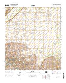
2013 Map of Mount Hayes D-5 NW
USGS Topo · Published 2013About this map
Delta Creek winds through the northwestern corner of this interior Alaskan landscape, which is defined by the high-elevation terrain of the Southeast Fairbanks region. The topography rises sharply from the creek bed towards the southern reaches of the quadrangle, where the contour lines indicate significant elevation changes within the survey area. This 2013 data from the U.S. Geological Survey illustrates the transition from the lower riparian environment to the more complex ridges and valleys that characterize this portion of the Tanana Valley watershed. The layout of the township and range boundaries, such as those separating Township 10 South and Township 11 South, highlights the systematic public land survey system used to organize this vast wilderness area for resource management and mapping.
Find a feature on this map
5 named features on this map. Tap any name to fly to it.
Don’t see what you’re looking for? This feature index may not catch every label — zoom into the map to look around manually.
Map Details
Editions of this 2013 Mount Hayes D-5 NW Map
This is the sole edition of this map. No revisions or reprints were ever made.
Other maps of this area

1949 · Big Delta A-6
USGS Topo · 1:63,360

1950 · Mount Hayes
USGS Topo · 1:250,000

1950 · Big Delta
USGS Topo · 1:250,000

1950 · Big Delta A-5
USGS Topo · 1:63,360

1950 · Mount Hayes D-6
USGS Topo · 1:63,360

1950 · Mount Hayes D-5
USGS Topo · 1:63,360

1951 · Big Delta
USGS Topo · 1:250,000

1951 · Mount Hayes
USGS Topo · 1:250,000
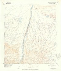
1951 · Big Delta A-6
USGS Topo · 1:63,360

1952 · Mount Hayes D-5
USGS Topo · 1:63,360