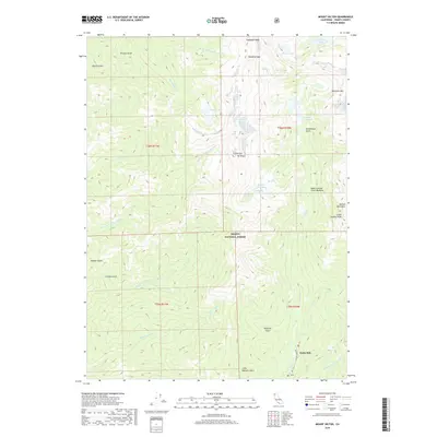
2018 Map of Mount Hilton
USGS Topo · Published 2018About this map
Mt Hilton and the high summits of the Trinity Alps define this high-altitude landscape within the Trinity National Forest. The map detail focuses on the sharp glaciated terrain of the northern California mountains, where numerous alpine water bodies like Sapphire Lake, Mirror Lake, and the Canyon Cr Lakes are carved into the granite. Towards the southeastern corner, the elevation drops toward the drainage of the E Fork N Fork Trinity River, where the settlement at Globe Mill sits near the confluence of Canyon Cr and Little E Fork Canyon Cr. This area illustrates the transition from the high peaks of Thompson Peak and Sawtooth Mtn to the lower gulches and creek meadows that historically supported local milling and timber operations.
Find a feature on this map
43 named features on this map. Tap any name to fly to it.
Don’t see what you’re looking for? This feature index may not catch every label — zoom into the map to look around manually.
Map Details
Editions of this 2018 Mount Hilton Map
This is the sole edition of this map. No revisions or reprints were ever made.
Other maps of this area

1886 · Shasta
USGS Topo · 1:250,000

1890 · Red Bluff
USGS Topo · 1:250,000

1894 · Red Bluff
USGS Topo · 1:250,000

1894 · Shasta
USGS Topo · 1:250,000

1909 · Big Bar
USGS Topo · 1:96,000

1913 · Weaverville
USGS Topo · 1:125,000

1915 · Big Bar and Vicinity
USGS Topo · 1:250,000

1923 · Sawyers Bar
USGS Topo · 1:125,000

1931 · Etna
USGS Topo · 1:96,000

1934 · Etna
USGS Topo · 1:125,000